Climbing Federispitz from Ziegelbrücke
ツアー: ツィーゲルブリュッケ駅からフェデリスピッツ山を登る(2020年5月24日)
ツアー案内・Hike overview- 距離・length: 13.91 km
- 登り、下り・ascents/descents: 1,517 m / 1,517 m
- 歩く時間・hiking time: 7 h 15 m
- スタート地点・starting point: Ziegelbrücke駅/station (425 m)
- 経由地・intermediate points: Federigrat (1,709 m), Federispitz (1,865), Plättlispitz (1,763 m)
- ゴール地点・end point: Ziegelbrücke駅/station (425 m)
- そのほか・remarks:
チューリッヒ市から近くから便利な山だが、強烈な山登りだから、体力に自信があり、1,500m以上の高さを登って降りることができる人のためにだけ!
The mountain is not too far from Zurich, which is nice, but the climb is a bit on the tough side fitness-wise, so it's only for people who are fit and confident they can climb and descend more than 1,500 height meters in one go. - ツアーマップ・LINK TO HIKING MAP
ツィーゲルブリュッケ駅(425m)に発着するツアーだ。最初の3時間半は急な林道を登っていく。フェデリグラート尾根(1,709m)に着くと、目の前に広がるチューリッヒ湖と低地の素晴らしい景色に驚かされるでしょう。フェデリシュピッツ山(1,865m)に着いたら、登っている人数に少し驚いていた。頂上のベンチから、シュペーア山、クールフルステン山脈、ヴァレン湖、グラールス渓谷、グラールニシュ山、チューリッヒの低地、湖、丘陵の360度の景色を楽しむことができる。帰りはプレットリシュピッツ山(1,763m)を越えるビューの素晴らしい道を選んだ。7時間15分のツアーだが、その上に少なくともビューを楽しめる1時間もカウントしなければならないだろう。またツィーゲルブリュッケ駅(425m)に戻ったら完全に疲れていた。終了後に駅売店で冷たい飲み物を購入することができるから、感謝していた!
Zieglebrücke Station (425 m) is the beginning and end of this strenuous tour. At the end, you'll be grateful for the station store with it's selection of cool drinks! The first 3 1/2 hours are spent climbing up steep forest paths, with only glimpses of the surrounding valleys, mountains and lakes. When you reach Federigrat (1,709 m), you'll be wowed by the amazing view across the low-lands and Lake Zurich that suddenly opens up in front of you. Continuing up the ridge until the peak of Federispitz (1,865 m) , I was somewhat surprised at how many people undertake this climb. All the benches on the peak were taken by hikers enjoying the 360° view of Speer, the Churfirsten range, Lake Walen, the Glarus valley, Glärnisch mountain, and the Zurich lowlands, lakes and hills. I chose the path over Plättlispitz (1,763 m) to return, which offers continuous views on Lake Walen and the mountains surrounding it. Very nice. Count in at least 1 hour to sit and enjoy the views when you're planning this hike.
 |
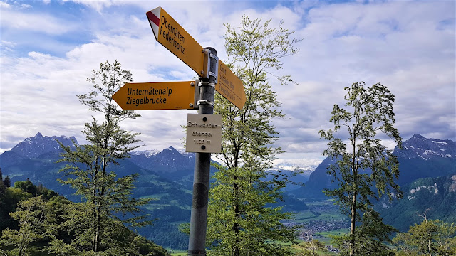
| シュヴァンデンヘンゲルでハーフウェイアップ(標高1,120 m) Half-way up at Schwandenchengel (1,120 m) |
 |
| フェデリグラート尾根への登りで振り返るビュー Looking back during the last climb up to Federigrat |
 |
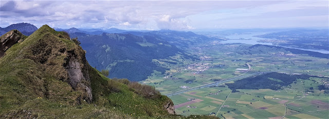
| フェデリグラート尾根からのビュー(標高1,709 m) View from Federigrat (1,709 m) on Lake Zurich |
 |
| フェデリグラート尾根からのビュー(標高1,709 m) View from Federigrat (1,709 m) on Lake Zurich |
 |
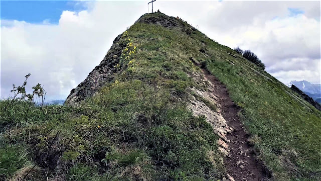
| フェデリシュピッツ山(1,865m)を登る最後の一分 Last minute up to Federspitz (1,865 m) |
 |
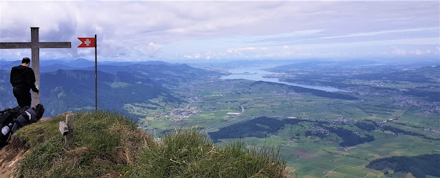
| フェデリシュピッツ山(1,865m) Federspitz (1,865 m) |
 |
| シュペーア山へのビュー View towards Speer |
 |
| プレットリスピッツ(1,763m)からフェデリスピッツへを振り返る Looking back at Federispitz from Plättlispitz (1,763 m) |
 |
| マットストッグ山、クールフルステン山脈、ワレン湖を眺めながら下る途中で休憩 Resting on the way down with a view of Mattstogg, the Churfirsten and Lake Walen |
コメント
コメントを投稿